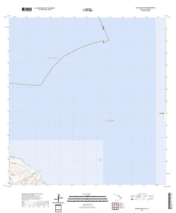
2024 Map of Kahoolawe OE NE
USGS Topo · Published 2024About this map
Kaho'olawe and the surrounding waters of the Pacific Ocean dominate this modern survey, which captures the northeast portion of the island and the maritime channel. The shoreline is marked by prominent points like Lae 'O Kuikui and the small settlement area of Hakioawa. The island's internal topography is defined by sharp elevation changes, notably around Lua 'O Keālialuna and deep drainage features such as Big Gulch and Waikahalulu Gulch.
Find a feature on this map
10 named features on this map. Tap any name to fly to it.
Don’t see what you’re looking for? This feature index may not catch every label — zoom into the map to look around manually.
Map Details
Editions of this 2024 Kahoolawe OE NE Map
This is the sole edition of this map. No revisions or reprints were ever made.
Other maps of this area

1929 · Kahoolawe
USGS Topo · 1:62,500

1954 · Maui
USGS Topo · 1:250,000

1954 · Maalaea
USGS Topo · 1:24,000

1954 · Puu O Kali
USGS Topo · 1:24,000

1954 · Makena
USGS Topo · 1:24,000

1966 · Maui
USGS Topo · 1:250,000

1974 · Maui
USGS Topo · 1:250,000
1983 · Maalaea
USGS Topo · 1:24,000
1983 · Puu O Kali
USGS Topo · 1:24,000
1983 · Makena
USGS Topo · 1:24,000