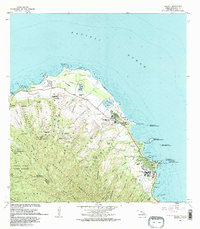
1983 Map of Kahuku
USGS Topo · Published 1983About this map
Kahuku Pt and the surrounding coastline of Oahu’s northern tip appear in this 1983 revision, showcasing a landscape defined by coastal settlements and extensive conservation areas. The region around Laie is notably developed, anchored by the Brigham Young University campus, the Polynesian Cultural Center, and the Laie Temple. To the west, the village of Kahuku is situated near Adams Field and several radio facilities. The map illustrates a complex water system of gulches and streams, such as Malaekahana Stream and Kaunala Stream, which drain the northern slopes of the Koolau Range. Large tracts of land are dedicated to environmental preservation and military use, including the Punamano Nat Wildlife Refuge and the Pupukea Paumalu Forest Reserve. Along the shore, numerous small islets like Mokuauia and Kukuihoolua are identified as state seabird sanctuaries.
Find a feature on this map
73 named features on this map. Tap any name to fly to it.
Don’t see what you’re looking for? This feature index may not catch every label — zoom into the map to look around manually.
Map Details
Editions of this 1983 Kahuku Map
2 editions found
Other maps of this area

1952 · Waimea
USGS Topo · 1:24,000

1953 · Haleiwa
USGS Topo · 1:24,000

1953 · Hauula
USGS Topo · 1:24,000

1954 · Oahu
USGS Topo · 1:250,000

1954 · Kahuku
USGS Topo · 1:24,000

1954 · Kahana
USGS Topo · 1:24,000

1960 · Haleiwa
USGS Topo · 1:24,000

1961 · Oahu
USGS Topo · 1:250,000

1965 · Oahu
USGS Topo · 1:250,000
1965 · Kahuku
USGS Topo · 1:24,000