1983 Map of Kahuku
USGS Topo · Published 1983About this map
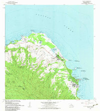
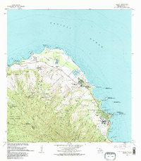
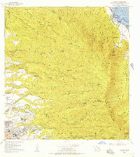
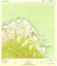
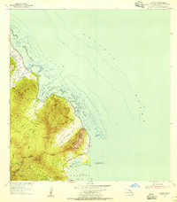
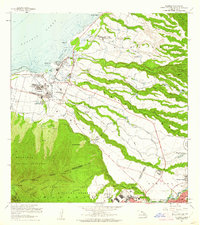
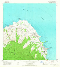
Kahuku and Laie occupy the northern tip of Oahu on this 1983 revision, showcasing a landscape where coastal agriculture and conservation meet major institutional development. The shoreline is marked by the presence of Punamano Nat Wildlife Refuge and the Ki Nat Wildlife Refuge, while an inland Aqueduct, siphon, and numerous wells indicate the complex water management required for the region.
Find a feature on this map
50 named features on this map. Tap any name to fly to it.
Don’t see what you’re looking for? This feature index may not catch every label — zoom into the map to look around manually.
Map Details
Editions of this 1983 Kahuku Map
2 editions found
Other maps of this area
1952 · Waimea
USGS Topo · 1:24,000
1953 · Haleiwa
USGS Topo · 1:24,000
1953 · Hauula
USGS Topo · 1:24,000

1954 · Oahu
USGS Topo · 1:250,000
1954 · Kahuku
USGS Topo · 1:24,000
1954 · Kahana
USGS Topo · 1:24,000
1960 · Haleiwa
USGS Topo · 1:24,000

1961 · Oahu
USGS Topo · 1:250,000

1965 · Oahu
USGS Topo · 1:250,000
1965 · Kahuku
USGS Topo · 1:24,000