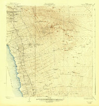
1928 Map of Kailua
USGS Topo · Published 1943About this map
Kailua sits at the coastal edge of a landscape defined by volcanic geology and agricultural transition in the late 1920s. The massive slopes of Puu Hualalai dominate the interior, surrounded by a complex system of land divisions including the Kalaoa Homesteads and numerous mauka tracts. Cultural and industrial history are visible through landmarks like the ancient Ahu-a-umi Heiau and the Kona Mill, reflecting the coexistence of Hawaiian heritage and the developing sugar and coffee economies of the era.
Find a feature on this map
119 named features on this map. Tap any name to fly to it.
Don’t see what you’re looking for? This feature index may not catch every label — zoom into the map to look around manually.
Map Details
Editions of this 1928 Kailua Map
3 editions found
Other maps of this area

1927 · Kaohe
USGS Topo · 1:62,500

1928 · Puako
USGS Topo · 1:62,500

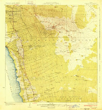
1928 · Kailua
USGS Topo · 1:62,500

1928 · Mauna Loa
USGS Topo · 1:62,500

1930 · Kaohe
USGS Topo · 1:62,500

1954 · Hawaii South
USGS Topo · 1:250,000

1954 · Hawaii North
USGS Topo · 1:250,000

1956 · Keamuku
USGS Topo · 1:24,000

1956 · Puu O Uo
USGS Topo · 1:24,000

1956 · Naohueleelua
USGS Topo · 1:24,000