
1928 Map of Kailua
USGS Topo · Published 1928About this map
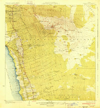
Puu Hualalei dominates the landscape of this 1920s survey, its volcanic slopes descending toward the Pacific through the Honuaula Forest Reserve and numerous homestead tracts. The settlement pattern of West Hawaii is clearly visible, with coastal hubs like Kailua and Keauhou connected to upland agricultural interests and early industrial sites such as the Sisal Mill and Kona Mill. This era captures a transition from traditional land divisions to organized homesteading, shown in the detailed labeling of the Kealakehe Homesteads and Ooma 2. Cultural landmarks like the Ahuena Heiau stand near the water, while the interior is marked by the Judd Road and isolated outposts including the Puu Lehua Ranch and a remote Sheep Station. The map provides a look at local infrastructure before modern development, identifying several community centers like Konawaena School and Kawunui Church.
Find a feature on this map
87 named features on this map. Tap any name to fly to it.
Don’t see what you’re looking for? This feature index may not catch every label — zoom into the map to look around manually.
Map Details
Editions of this 1928 Kailua Map
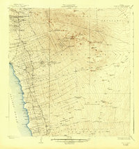
3 editions found
Other maps of this area

1927 · Kaohe
USGS Topo · 1:62,500

1928 · Puako
USGS Topo · 1:62,500

1928 · Mauna Loa
USGS Topo · 1:62,500

1930 · Kaohe
USGS Topo · 1:62,500

1954 · Hawaii South
USGS Topo · 1:250,000

1954 · Hawaii North
USGS Topo · 1:250,000

1956 · Keamuku
USGS Topo · 1:24,000

1956 · Puu O Uo
USGS Topo · 1:24,000

1956 · Naohueleelua
USGS Topo · 1:24,000

1959 · Hawaii South
USGS Topo · 1:250,000