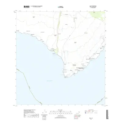
2017 Map of Kalae
USGS Topo · Published 2017About this map
Kalae occupies the southernmost tip of the Island of Hawai'i, where the volcanic landscape meets the Pacific Ocean. This 2017 survey details a coastline defined by geological history, most notably the prominent Lava Flow of 1868 that cuts a wide path toward the sea. The cultural landscape is anchored by the Ala Kahakai National Historic Trail, which traverses the coastal shelf past numerous kīpuka—islands of older land and vegetation surrounded by more recent flows—such as Kipukakamao and Kipukakuniaiu.
Find a feature on this map
57 named features on this map. Tap any name to fly to it.
Don’t see what you’re looking for? This feature index may not catch every label — zoom into the map to look around manually.
Map Details
Editions of this 2017 Kalae Map
This is the sole edition of this map. No revisions or reprints were ever made.
Other maps of this area

1924 · Kalae
USGS Topo · 1:62,500

1924 · Honuapo
USGS Topo · 1:62,500

1928 · Hoopuloa
USGS Topo · 1:62,500

1954 · Hawaii South
USGS Topo · 1:250,000

1959 · Hawaii South
USGS Topo · 1:250,000

1961 · Hawaii South
USGS Topo · 1:250,000

1962 · Hawaii South
USGS Topo · 1:250,000

1962 · Puu Hou
USGS Topo · 1:24,000

1962 · Kahuku Ranch
USGS Topo · 1:24,000

1962 · Pohue Bay
USGS Topo · 1:24,000