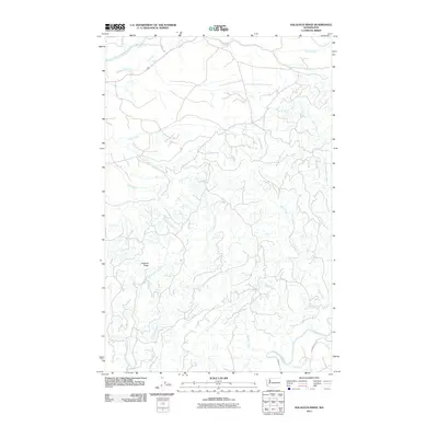
2011 Map of Kalaloch Ridge
USGS Topo · Published 2011About this map
Kalaloch Ridge dominates the center of this terrain-heavy survey in Jefferson County, which maps the intricate drainage systems between two significant coastal rivers. The Hoh River cuts across the northern edge of the sheet, while the Clearwater River and its tributary Elkhorn Creek define the southern landscape. This area is characterized by a dense web of smaller watercourses, including Steamboat Creek and Kalaloch Creek, which have carved deep valleys into the ridge system. The few named access points, such as G L Shake Rd and Clearwater Rd, suggest a landscape primarily utilized for timber management or watershed protection rather than residential settlement. This 2011 survey provides a clear look at the complex hydrography of the Olympic Peninsula, from the Mink Creek headwaters to the Nolan Creek drainage.
Find a feature on this map
19 named features on this map. Tap any name to fly to it.
Don’t see what you’re looking for? This feature index may not catch every label — zoom into the map to look around manually.
Map Details
Editions of this 2011 Kalaloch Ridge Map
This is the sole edition of this map. No revisions or reprints were ever made.
Other maps of this area

1939 · Forks
USGS Topo · 1:62,500

1943 · Spruce Mountain
USGS Topo · 1:62,500

1943 · Copalis Beach
USGS Topo · 1:250,000

1951 · Copalis Beach
USGS Topo · 1:250,000

1956 · Destruction Island
USGS Topo · 1:62,500

1956 · Spruce Mtn.
USGS Topo · 1:62,500

1956 · Salmon River
USGS Topo · 1:62,500

1957 · Forks
USGS Topo · 1:62,500

1957 · Copalis Beach
USGS Topo · 1:250,000

1963 · Copalis Beach
USGS Topo · 1:250,000