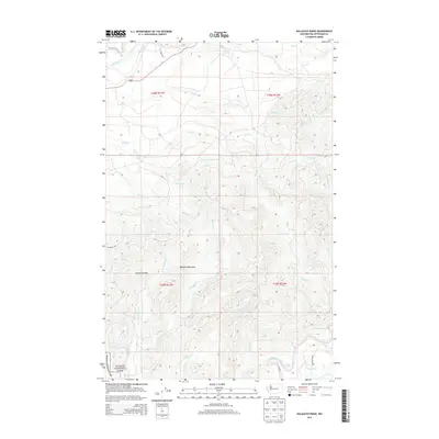
2014 Map of Kalaloch Ridge
USGS Topo · Published 2014About this map
The Olympic Mountains dominate this 2014 terrain study, defining the high-relief landscape of western Jefferson County. Much of the southern and western portions of the sheet fall within the protected boundaries of Olympic National Park, where the Kalaloch Ridge serves as a prominent geographic spine. The map documents an intricate drainage system feeding into the coastal watershed, notably the north-flowing Hoh River and the southward winding Clearwater River. Local waterways like Steamboat Cr and Braden Cr carve deep through the forested ridges, while the river systems are marked by named navigational features such as Skookumchuck Rapids and Barker Rapids. Human presence is confined to the periphery, with access provided by primitive routes such as Oil City Rd, G L Shake Rd, and NPS Road 1435, reflecting the area's role as a managed wilderness and timber resource zone.
Find a feature on this map
30 named features on this map. Tap any name to fly to it.
Don’t see what you’re looking for? This feature index may not catch every label — zoom into the map to look around manually.
Map Details
Editions of this 2014 Kalaloch Ridge Map
This is the sole edition of this map. No revisions or reprints were ever made.
Other maps of this area

1939 · Forks
USGS Topo · 1:62,500

1943 · Spruce Mountain
USGS Topo · 1:62,500

1943 · Copalis Beach
USGS Topo · 1:250,000

1951 · Copalis Beach
USGS Topo · 1:250,000

1956 · Destruction Island
USGS Topo · 1:62,500

1956 · Spruce Mtn.
USGS Topo · 1:62,500

1956 · Salmon River
USGS Topo · 1:62,500

1957 · Forks
USGS Topo · 1:62,500

1957 · Copalis Beach
USGS Topo · 1:250,000

1963 · Copalis Beach
USGS Topo · 1:250,000