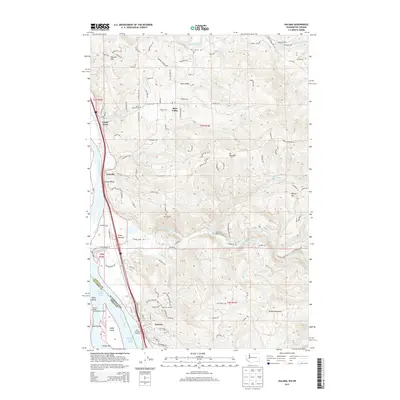
2013 Map of Kalama
USGS Topo · Published 2013About this map
Kalama and the surrounding riverfront settlements define this 2013 topographic study of the Columbia River corridor. The geography is dominated by the industrial and maritime infrastructure along the Great Northern Ry, including the Port of Kalama Marina and the Kalama Lower Range navigation channel. Away from the water, the terrain rises sharply toward Green Mountain and Battle Mtn, where smaller communities like Rose Valley and Carrolls are established among the winding creek valleys.
Find a feature on this map
123 named features on this map. Tap any name to fly to it.
Don’t see what you’re looking for? This feature index may not catch every label — zoom into the map to look around manually.
Map Details
Editions of this 2013 Kalama Map
This is the sole edition of this map. No revisions or reprints were ever made.
Other maps of this area

1921 · Kalama
USGS Topo · 1:62,500

1922 · St. Helens
USGS Topo · 1:62,500

1940 · La Center
USGS Topo · 1:62,500

1941 · St Helens
USGS Topo · 1:62,500

1943 · Pigeon Springs
USGS Topo · 1:62,500

1943 · St Helens
USGS Topo · 1:62,500

1948 · Vancouver
USGS Topo · 1:250,000

1950 · Vancouver
USGS Topo · 1:250,000

1950 · Vancouver
USGS Topo · 1:250,000

1953 · Hoquiam
USGS Topo · 1:250,000