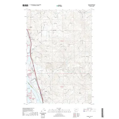
2020 Map of Kalama
USGS Topo · Published 2020About this map
The Columbia River dominates the western edge of this landscape, separating the Washington and Oregon borderlands near the port city of Kalama. The river's influence is evident in the complex of islands and bars like Cottonwood Island, Sandy Island, and Hunter Bar, which shift alongside the Kalama Upper Range and Kalama Lower Range navigation channels. Inland, the terrain rises toward the volcanic peaks of the Cascade foothills, including Green Mountain and Battle Mtn.
Find a feature on this map
127 named features on this map. Tap any name to fly to it.
Don’t see what you’re looking for? This feature index may not catch every label — zoom into the map to look around manually.
Map Details
Editions of this 2020 Kalama Map
This is the sole edition of this map. No revisions or reprints were ever made.
Other maps of this area

1921 · Kalama
USGS Topo · 1:62,500

1922 · St. Helens
USGS Topo · 1:62,500

1940 · La Center
USGS Topo · 1:62,500

1941 · St Helens
USGS Topo · 1:62,500

1943 · Pigeon Springs
USGS Topo · 1:62,500

1943 · St Helens
USGS Topo · 1:62,500

1948 · Vancouver
USGS Topo · 1:250,000

1950 · Vancouver
USGS Topo · 1:250,000

1950 · Vancouver
USGS Topo · 1:250,000

1953 · Hoquiam
USGS Topo · 1:250,000