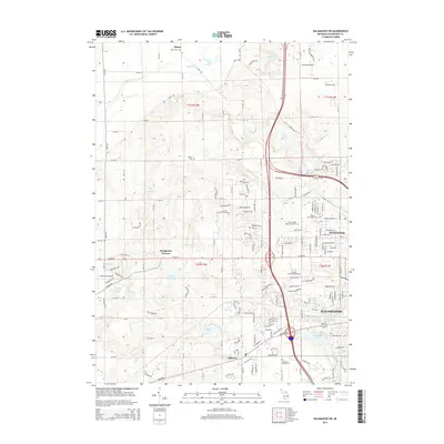
2014 Map of Kalamazoo SW
USGS Topo · Published 2014About this map
Kalamazoo and its western outskirts appear in this early 21st-century record of suburban expansion and historical preservation. The area is defined by a dense network of residential subdivisions, such as Westwood, set against the backdrop of Michigan's characteristic kettle lakes, including Asylum Lake and South Lake. The transition from urban centers to more rural landscape is evident around Doughertys Corners and the community of Oshtemo. Genealogists will find a concentration of local history in the many preserved burial grounds throughout the quadrangle, from the Alamo Cem in the north to the Genesee Prairie Cem further south. Modern infrastructure is prominent, featuring the Everest Institute-Kalamazoo and Newman's Airport, showing how the land has adapted to educational and transportation needs of the new millennium while maintaining its agricultural and glacial roots.
Find a feature on this map
95 named features on this map. Tap any name to fly to it.
Don’t see what you’re looking for? This feature index may not catch every label — zoom into the map to look around manually.
Map Details
Editions of this 2014 Kalamazoo SW Map
This is the sole edition of this map. No revisions or reprints were ever made.
Other maps of this area

1916 · Kalamazoo
USGS Topo · 1:62,500

1918 · Kalamazoo
USGS Topo · 1:62,500

1922 · Schoolcraft
USGS Topo · 1:62,500

1943 · Kalamazoo
USGS Topo · 1:62,500

1943 · Schoolcraft
USGS Topo · 1:62,500

1944 · Marcellus
USGS Topo · 1:62,500

1946 · Marcellus
USGS Topo · 1:62,500

1946 · Gobles
USGS Topo · 1:62,500

1948 · Gobles
USGS Topo · 1:62,500

1949 · Gobles
USGS Topo · 1:62,500
Featured Places
- Kalamazoo, MI
- Alamo Township, MI
- Cooper Charter Township, MI
- Kalamazoo Charter Township, MI
- Oshtemo Charter Township, MI