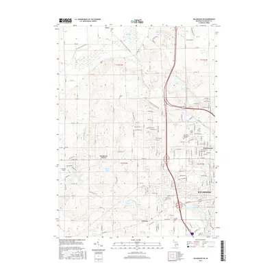
2017 Map of Kalamazoo SW
USGS Topo · Published 2017About this map
The northwest corner of Kalamazoo and the surrounding townships of Alamo and Oshtemo reveal a landscape defined by glacial kettle lakes and a network of historic cemeteries. Small water bodies like Bonnie Castle Lake, Asylum Lake, and Dustin Lake dot the terrain, while the Kal-Haven Trail State Park follows a former railroad corridor through the Owen Hills. This modern survey shows the transition from the dense residential developments of Westwood to the more dispersed rural character of Doughertys Corners. Local history researchers can pinpoint numerous family and community burial grounds, including Liberty Cem, Grand Prairie Cem, and Genesee Prairie Cem. The presence of Newman's Airport and major transportation routes illustrates the region's late-twentieth-century infrastructure development as suburban expansion moved westward from the city center.
Find a feature on this map
149 named features on this map. Tap any name to fly to it.
Don’t see what you’re looking for? This feature index may not catch every label — zoom into the map to look around manually.
Map Details
Editions of this 2017 Kalamazoo SW Map
This is the sole edition of this map. No revisions or reprints were ever made.
Other maps of this area

1916 · Kalamazoo
USGS Topo · 1:62,500

1918 · Kalamazoo
USGS Topo · 1:62,500

1922 · Schoolcraft
USGS Topo · 1:62,500

1943 · Kalamazoo
USGS Topo · 1:62,500

1943 · Schoolcraft
USGS Topo · 1:62,500

1944 · Marcellus
USGS Topo · 1:62,500

1946 · Marcellus
USGS Topo · 1:62,500

1946 · Gobles
USGS Topo · 1:62,500

1948 · Gobles
USGS Topo · 1:62,500

1949 · Gobles
USGS Topo · 1:62,500
Featured Places
- Kalamazoo, MI
- Alamo Township, MI
- Cooper Charter Township, MI
- Kalamazoo Charter Township, MI
- Oshtemo Charter Township, MI