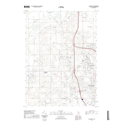
2019 Map of Kalamazoo SW
USGS Topo · Published 2019About this map
The western outskirts of Kalamazoo and the residential community of Westwood anchor this 2019 survey, showing the transition from urban density to the wooded hills of southwest Michigan. The Kal-Haven Trail State Park bisects the landscape, following a former railroad corridor through the northern sections near Alamo. This area is dotted with small kettle lakes and wetlands, including Asylum Lake, Bonnie Castle Lake, and Dustin Lake, which influence the local geography and road patterns.
Find a feature on this map
157 named features on this map. Tap any name to fly to it.
Don’t see what you’re looking for? This feature index may not catch every label — zoom into the map to look around manually.
Map Details
Editions of this 2019 Kalamazoo SW Map
This is the sole edition of this map. No revisions or reprints were ever made.
Other maps of this area

1916 · Kalamazoo
USGS Topo · 1:62,500

1918 · Kalamazoo
USGS Topo · 1:62,500

1922 · Schoolcraft
USGS Topo · 1:62,500

1943 · Kalamazoo
USGS Topo · 1:62,500

1943 · Schoolcraft
USGS Topo · 1:62,500

1944 · Marcellus
USGS Topo · 1:62,500

1946 · Marcellus
USGS Topo · 1:62,500

1946 · Gobles
USGS Topo · 1:62,500

1948 · Gobles
USGS Topo · 1:62,500

1949 · Gobles
USGS Topo · 1:62,500
Featured Places
- Kalamazoo, MI
- Alamo Township, MI
- Cooper Charter Township, MI
- Kalamazoo Charter Township, MI
- Oshtemo Charter Township, MI