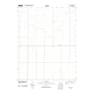
2009 Map of Kalvesta
USGS Topo · Published 2009About this map
Kalvesta serves as the central point of this High Plains landscape in Finney County, located along the intersection of local routes in a region defined by its vast agricultural grid. This 2009 survey by the U.S. Geological Survey captures the rural infrastructure of western Kansas, where a series of family and local roads such as N Zeim Grade Rd, Renstrom Rd, and E Hamil Rd provide access to the surrounding farmsteads. The drainage patterns on this sheet reveal the intricate network of ephemeral draws that traverse the plains between N Holden Rd and N Byler Rd, illustrating how the natural topography interacts with the strict section lines of the midwestern survey system.
Find a feature on this map
9 named features on this map. Tap any name to fly to it.
Don’t see what you’re looking for? This feature index may not catch every label — zoom into the map to look around manually.
Map Details
Editions of this 2009 Kalvesta Map
This is the sole edition of this map. No revisions or reprints were ever made.
Other maps of this area

1892 · Dodge
USGS Topo · 1:125,000

1955 · Dodge City
USGS Topo · 1:250,000

1955 · Scott City
USGS Topo · 1:250,000

1958 · Dodge City
USGS Topo · 1:250,000

1958 · Scott City
USGS Topo · 1:250,000

1959 · Dodge City
USGS Topo · 1:250,000

1968 · Cimarron NW
USGS Topo · 1:24,000

1968 · Dodge City NW
USGS Topo · 1:24,000

1968 · Cimarron NE
USGS Topo · 1:24,000

1974 · Ravanna
USGS Topo · 1:24,000