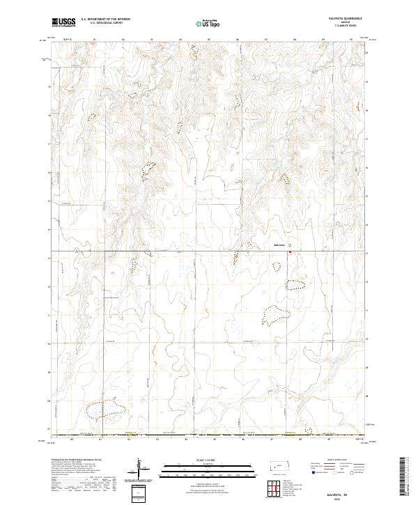
2022 Map of Kalvesta
USGS Topo · Published 2022About this map
Kalvesta serves as the central hub of this High Plains landscape, situated at a crossroads in northern Finney County. The area is defined by a grid of rural thoroughfares such as N Dewey Rd and N Byler Rd, which facilitate transport across a terrain marked by numerous ephemeral wetlands and depressions. The southern portion of the quadrangle is bisected by the winding course of Sand Cr, a seasonal waterway that draws a distinct line through the agricultural sections. Along the southern boundary, Gray Co Line Rd marks the transition into Gray County. This 2022 survey illustrates a modern rural infrastructure where long-established section-line roads like E Bell Rd and E Oyler Rd continue to organize the sparsely populated cattle and farming country of western Kansas.
Find a feature on this map
21 named features on this map. Tap any name to fly to it.
Don’t see what you’re looking for? This feature index may not catch every label — zoom into the map to look around manually.
Map Details
Editions of this 2022 Kalvesta Map
This is the sole edition of this map. No revisions or reprints were ever made.
Other maps of this area

1892 · Dodge
USGS Topo · 1:125,000

1955 · Dodge City
USGS Topo · 1:250,000

1955 · Scott City
USGS Topo · 1:250,000

1958 · Dodge City
USGS Topo · 1:250,000

1958 · Scott City
USGS Topo · 1:250,000

1959 · Dodge City
USGS Topo · 1:250,000

1968 · Cimarron NW
USGS Topo · 1:24,000

1968 · Dodge City NW
USGS Topo · 1:24,000

1968 · Cimarron NE
USGS Topo · 1:24,000

1974 · Ravanna
USGS Topo · 1:24,000