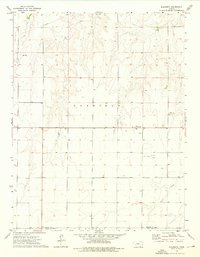
1974 Map of Kalvesta
USGS Topo · Published 1976About this map
Kalvesta sits at the center of this 1970s western Kansas landscape, serving as a hub where Highway 156 and Highway 23 intersect. The terrain is characterized by the winding path of Sand Creek in the south and the township boundaries of Garfield. This era shows a rural economy supported by local extraction, evidenced by the Caliche Pit and Sandpit located in the eastern portion of the quadrangle. Small geographic markers such as Sims and Ford denote points of local significance along the county lines. A large Pipeline cuts across the northern section of the map, illustrating the infrastructure required for energy transport across the High Plains. The numerous benchmarks, including BM 2668 and BM 2725, provide precise topographic data for this section of Finney County and Gray County.
Find a feature on this map
15 named features on this map. Tap any name to fly to it.
Don’t see what you’re looking for? This feature index may not catch every label — zoom into the map to look around manually.
Map Details
Editions of this 1974 Kalvesta Map
This is the sole edition of this map. No revisions or reprints were ever made.
Other maps of this area

1892 · Dodge
USGS Topo · 1:125,000

1955 · Dodge City
USGS Topo · 1:250,000

1955 · Scott City
USGS Topo · 1:250,000

1958 · Dodge City
USGS Topo · 1:250,000

1958 · Scott City
USGS Topo · 1:250,000

1959 · Dodge City
USGS Topo · 1:250,000

1968 · Cimarron NW
USGS Topo · 1:24,000

1968 · Dodge City NW
USGS Topo · 1:24,000

1968 · Cimarron NE
USGS Topo · 1:24,000

1974 · Ravanna
USGS Topo · 1:24,000