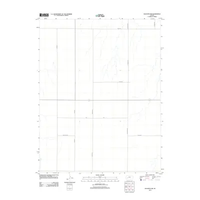
2012 Map of Kalvesta SW
USGS Topo · Published 2012About this map
High plains agriculture and the grid of section-line roads define this Finney County landscape. The mapping of the southwestern corner of the Kalvesta area shows a terrain dominated by intermittent drainage patterns and a highly structured transportation network typical of the Kansas prairie. Named thoroughfares such as N Road 36 and N Ingalls Rd reveal the local preference for numeric and family-based nomenclature. Of particular interest to genealogists and local historians are the family-named landmarks Harry Oyler Rd and E Oyler Rd in the southern portion of the quadrangle. These named roads often correlate with established farmsteads or historical family tracts. The map also records the crossing of V Rd and E Phipps Rd, which serve as primary connectors across this rural expanse.
Find a feature on this map
10 named features on this map. Tap any name to fly to it.
Don’t see what you’re looking for? This feature index may not catch every label — zoom into the map to look around manually.
Map Details
Editions of this 2012 Kalvesta SW Map
This is the sole edition of this map. No revisions or reprints were ever made.
Other maps of this area

1892 · Dodge
USGS Topo · 1:125,000

1896 · Garden
USGS Topo · 1:125,000

1955 · Dodge City
USGS Topo · 1:250,000

1955 · Scott City
USGS Topo · 1:250,000

1958 · Dodge City
USGS Topo · 1:250,000

1958 · Scott City
USGS Topo · 1:250,000

1959 · Dodge City
USGS Topo · 1:250,000

1968 · Cimarron NW
USGS Topo · 1:24,000

1968 · Cimarron NE
USGS Topo · 1:24,000
1968 · Pierceville NE
USGS Topo · 1:24,000