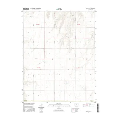
2015 Map of Kalvesta SW
USGS Topo · Published 2015About this map
Finney County and Gray County meet along the southern boundary of this High Plains landscape, where the survey reveals a strictly organized grid of agricultural development. The terrain is defined by a dense network of sectional roads, with Gray Co Line Rd and E Kansas Ave serving as primary east-west corridors. This map provides an intimate look at the 21st-century land-use patterns in western Kansas, showing how rural life is structured around family-named or utilitarian thoroughfares like N York Rd, N Ingalls Rd, and N Community Rd. The presence of numerous small wetlands scattered across the plains, particularly in Township 23 South, Range 28 West, suggests a landscape of seasonal prairie potholes or playas that persist amid the expansive farming tracts. This level of detail is vital for researchers tracking land ownership and the evolution of the road networks that have defined this region since the original land surveys.
Find a feature on this map
16 named features on this map. Tap any name to fly to it.
Don’t see what you’re looking for? This feature index may not catch every label — zoom into the map to look around manually.
Map Details
Editions of this 2015 Kalvesta SW Map
This is the sole edition of this map. No revisions or reprints were ever made.
Other maps of this area

1892 · Dodge
USGS Topo · 1:125,000

1896 · Garden
USGS Topo · 1:125,000

1955 · Dodge City
USGS Topo · 1:250,000

1955 · Scott City
USGS Topo · 1:250,000

1958 · Dodge City
USGS Topo · 1:250,000

1958 · Scott City
USGS Topo · 1:250,000

1959 · Dodge City
USGS Topo · 1:250,000

1968 · Cimarron NW
USGS Topo · 1:24,000

1968 · Cimarron NE
USGS Topo · 1:24,000
1968 · Pierceville NE
USGS Topo · 1:24,000