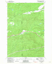
1981 Map of Kamilche Valley
USGS Topo · Published 1982About this map
Kamilche Valley serves as a geographic centerpiece for this 1970s-era study, where the industrial presence of the Burlington Northern railroad meets the dense timberlands of the Capitol State Forest. The map documents a landscape of transition at the meeting point of Mason, Grays Harbor, and Thurston counties, defined by the winding course of Skookum Creek and the residential clusters of Marmac and Forbes.
Find a feature on this map
34 named features on this map. Tap any name to fly to it.
Don’t see what you’re looking for? This feature index may not catch every label — zoom into the map to look around manually.
Map Details
Editions of this 1981 Kamilche Valley Map
This is the sole edition of this map. No revisions or reprints were ever made.
Other maps of this area

1939 · Shelton
USGS Topo · 1:62,500

1941 · Gate
USGS Topo · 1:62,500

1941 · Ford
USGS Topo · 1:62,500

1943 · Nahwatzel Lake
USGS Topo · 1:62,500

1953 · Hoquiam
USGS Topo · 1:250,000

1953 · Rochester
USGS Topo · 1:62,500

1953 · Malone
USGS Topo · 1:62,500

1953 · Shelton
USGS Topo · 1:62,500

1953 · Elma
USGS Topo · 1:62,500

1957 · Hoquiam
USGS Topo · 1:250,000