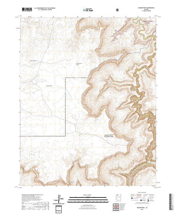
2021 Map of Kanab Point
USGS Topo · Published 2021About this map
Grand Canyon National Park and the Kaibab National Forest dominate this section of the Arizona landscape, where the high desert terrain breaks sharply toward the river below. The topography is defined by massive promontories like Kanab Point and Shanub Point that overlook the intricate drainages of Kanab Cr and Jumpup Canyon. These deep incisions in the Kanab Plateau create a complex network of vertical relief, leading down to the Colorado River at the southern edge of the quadrangle.
Find a feature on this map
26 named features on this map. Tap any name to fly to it.
Don’t see what you’re looking for? This feature index may not catch every label — zoom into the map to look around manually.
Map Details
Editions of this 2021 Kanab Point Map
This is the sole edition of this map. No revisions or reprints were ever made.
Other maps of this area

1886 · Kaibab
USGS Topo · 1:250,000

1953 · Grand Canyon
USGS Topo · 1:250,000

1954 · Heaton Knolls SE
USGS Topo · 1:24,000

1954 · Heaton Knolls
USGS Topo · 1:62,500

1957 · Grand Canyon
USGS Topo · 1:250,000

1957 · Jumpup Canyon
USGS Topo · 1:62,500

1958 · Grand Canyon
USGS Topo · 1:250,000

1960 · Grand Canyon
USGS Topo · 1:250,000

1962 · Kanab Point
USGS Topo · 1:62,500

1962 · Tuckup Canyon
USGS Topo · 1:62,500