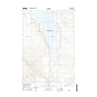
2015 Map of Kane
USGS Topo · Published 2015About this map
Bighorn Canyon National Recreation Area dominates this landscape, where the confluence of the Shoshone River and the Bighorn River feeds into the expansive Bighorn Lake. The settlement of Kane sits near the northern reaches of the lake, positioned at a critical junction of waterways and local routes such as Road 20. The terrain is defined by dramatic elevation changes, notably at Katys Nipple and the heights of Little Sheep Mtn.
Find a feature on this map
30 named features on this map. Tap any name to fly to it.
Don’t see what you’re looking for? This feature index may not catch every label — zoom into the map to look around manually.
Map Details
Editions of this 2015 Kane Map
This is the sole edition of this map. No revisions or reprints were ever made.
Other maps of this area

1955 · Cody
USGS Topo · 1:250,000

1958 · Cody
USGS Topo · 1:250,000

1962 · Cody
USGS Topo · 1:250,000

1964 · Kane
USGS Topo · 1:24,000
1964 · Simmons Canyon
USGS Topo · 1:24,000

1964 · Lovell Lakes
USGS Topo · 1:24,000

1964 · Sykes Spring
USGS Topo · 1:24,000
1964 · Natural Trap Cave
USGS Topo · 1:24,000
1966 · Cottonwood Canyon
USGS Topo · 1:24,000

1966 · North Emblem Reservoir
USGS Topo · 1:24,000