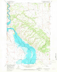
1964 Map of Natural Trap Cave
USGS Topo · Published 1968About this map
Yellowtail Reservoir and the Bighorn River dominate this landscape during a period of significant hydrological transition for Big Horn County. The 1964 field check captures the area just as the Bighorn Canyon National Recreation Area was being established, following the damming of the river. Evidence of the valley's earlier life remains at Kane Cem and along the Big Fork Canal near the southern margin.
Find a feature on this map
27 named features on this map. Tap any name to fly to it.
Don’t see what you’re looking for? This feature index may not catch every label — zoom into the map to look around manually.
Map Details
Editions of this 1964 Natural Trap Cave Map
2 editions found
Other maps of this area

1954 · Billings
USGS Topo · 1:250,000

1955 · Cody
USGS Topo · 1:250,000

1957 · Billings
USGS Topo · 1:250,000

1958 · Billings
USGS Topo · 1:250,000

1958 · Cody
USGS Topo · 1:250,000

1962 · Cody
USGS Topo · 1:250,000

1964 · Kane
USGS Topo · 1:24,000

1964 · Two Point
USGS Topo · 1:24,000
1964 · Simmons Canyon
USGS Topo · 1:24,000

1964 · Lovell Lakes
USGS Topo · 1:24,000