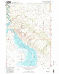
1964 Map of Natural Trap Cave
USGS Topo · Published 1968About this map
Bighorn Canyon dominates this 1963-1964 survey, capturing a landscape in transition as the Yellowtail Reservoir was being established with a normal pool elevation of 3640 feet. The rising waters of the Bighorn River define the Bighorn Canyon National Recreation Area, winding past geological landmarks like Horseshoe Bend and through the constriction of The Narrows. This period shows the coexistence of new water management projects alongside legacy mining operations, including the Titan Mine and Lisbon Mines, with the latter featuring a labeled Glory Hole.
Find a feature on this map
31 named features on this map. Tap any name to fly to it.
Don’t see what you’re looking for? This feature index may not catch every label — zoom into the map to look around manually.
Map Details
Editions of this 1964 Natural Trap Cave Map
2 editions found
Other maps of this area

1954 · Billings
USGS Topo · 1:250,000

1955 · Cody
USGS Topo · 1:250,000

1957 · Billings
USGS Topo · 1:250,000

1958 · Billings
USGS Topo · 1:250,000

1958 · Cody
USGS Topo · 1:250,000

1962 · Cody
USGS Topo · 1:250,000

1964 · Kane
USGS Topo · 1:24,000

1964 · Two Point
USGS Topo · 1:24,000
1964 · Simmons Canyon
USGS Topo · 1:24,000

1964 · Lovell Lakes
USGS Topo · 1:24,000