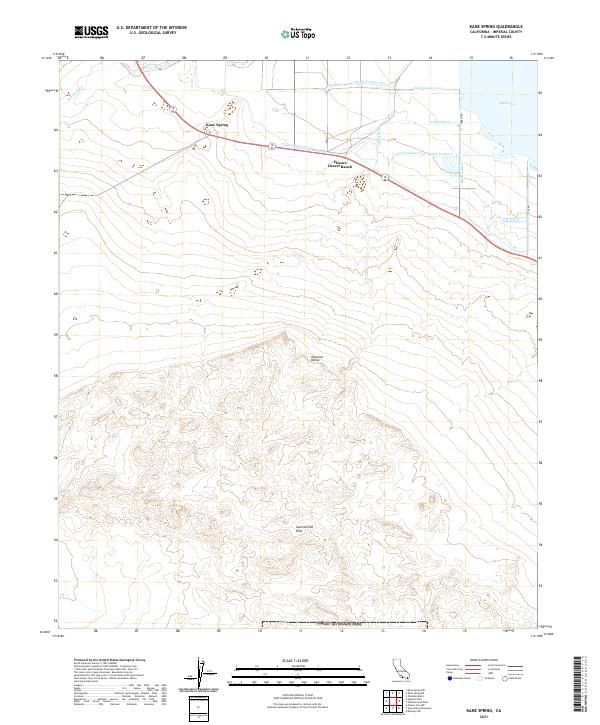
2021 Map of Kane Spring
USGS Topo · Published 2021About this map
The Imperial Valley landscape meets the southwestern shore of the Salton Sea in this topographical survey, showing a region defined by its desert water management and distinctive geology. Agricultural infrastructure is dense in the northeast corner, where a network of irrigation channels like the Trifolium Extension, Barth Lateral, and Lateral Number One divert water into the low-lying basin. This highly engineered hydrological system contrasts sharply with the arid terrain of the Superstition Hills to the south.
Find a feature on this map
21 named features on this map. Tap any name to fly to it.
Don’t see what you’re looking for? This feature index may not catch every label — zoom into the map to look around manually.
Map Details
Editions of this 2021 Kane Spring Map
This is the sole edition of this map. No revisions or reprints were ever made.
Other maps of this area

1915 · El Centro
USGS Topo · 1:125,000

1940 · Brawley
USGS Topo · 1:62,500

1940 · Kane Spring
USGS Topo · 1:62,500

1940 · Plaster City
USGS Topo · 1:62,500

1942 · El Centro
USGS Topo · 1:250,000

1943 · Brawley
USGS Topo · 1:62,500

1944 · Plaster City
USGS Topo · 1:62,500

1944 · Kane Spring
USGS Topo · 1:62,500

1944 · Calipatria
USGS Topo · 1:62,500

1954 · El Centro
USGS Topo · 1:250,000