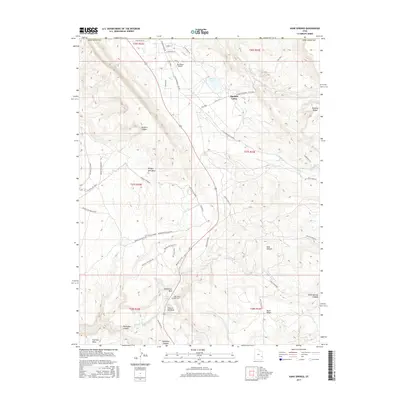
2017 Map of Kane Springs
USGS Topo · Published 2017About this map
Spanish Valley serves as the central corridor of this San Juan County landscape, where the waters of Pack Cr and Kens Lake provide a rare respite from the surrounding high-desert topography. The map illustrates a transition between the valley floor and dramatic uplands like Brumley Ridge and Bridger Jack Mesa. A unique cluster of features appears at the southern end of the valley, centered on the Hole-in-the-rock settlement and the Hole 'n the Rock Cem, illustrating how local habitation has adapted to the distinct sandstone formations. Transportation patterns are defined by the La Sal Mountain Loop Rd and the 24-Hours of Moab route, which navigate the complex network of drainages including Kane Springs Canyon and Muleshoe Canyon. North of the mesa, the Sky Ranch Airport anchors the residential development of Sunny Acres Ln and Allen St.
Find a feature on this map
51 named features on this map. Tap any name to fly to it.
Don’t see what you’re looking for? This feature index may not catch every label — zoom into the map to look around manually.
Map Details
Editions of this 2017 Kane Springs Map
This is the sole edition of this map. No revisions or reprints were ever made.
Other maps of this area

1885 · La Sal
USGS Topo · 1:250,000

1954 · Mt Peale 2 SW
USGS Topo · 1:24,000

1954 · Mt Peale 2 NW
USGS Topo · 1:24,000

1954 · Mt Peale 2 SE
USGS Topo · 1:24,000

1954 · Mt. Waas 3 SE
USGS Topo · 1:24,000

1954 · Carlisle 1 NE
USGS Topo · 1:24,000

1954 · Carlisle 1 SE
USGS Topo · 1:24,000

1954 · Mt Peale 2 NE
USGS Topo · 1:24,000

1954 · Mt. Waas 3 SW
USGS Topo · 1:24,000

1954 · La Sal Junction
USGS Topo · 1:62,500