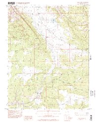
1996 Map of Kane Springs
USGS Topo · Published 2002About this map
Spanish Valley and the high sandstone plateaus of the Grand and San Juan County line define this desert landscape as it was surveyed in the late twentieth century. The map centers on the critical water management and transport infrastructure of the region, featuring Kens Lake with its associated aqueduct and spillway. The presence of a landing strip and a radio facility alongside several gravel pits speaks to the industrial and logistical utility of this corridor south of Moab.
Find a feature on this map
30 named features on this map. Tap any name to fly to it.
Don’t see what you’re looking for? This feature index may not catch every label — zoom into the map to look around manually.
Map Details
Editions of this 1996 Kane Springs Map
This is the sole edition of this map. No revisions or reprints were ever made.
Other maps of this area

1885 · La Sal
USGS Topo · 1:250,000

1954 · Mt Peale 2 SW
USGS Topo · 1:24,000

1954 · Mt Peale 2 NW
USGS Topo · 1:24,000

1954 · Mt Peale 2 SE
USGS Topo · 1:24,000

1954 · Mt. Waas 3 SE
USGS Topo · 1:24,000

1954 · Carlisle 1 NE
USGS Topo · 1:24,000

1954 · Carlisle 1 SE
USGS Topo · 1:24,000

1954 · Mt Peale 2 NE
USGS Topo · 1:24,000

1954 · Mt. Waas 3 SW
USGS Topo · 1:24,000

1954 · La Sal Junction
USGS Topo · 1:62,500