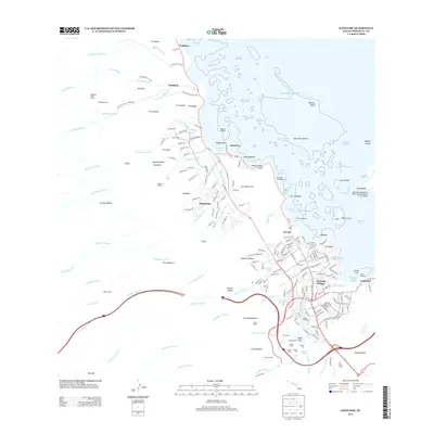
2013 Map of Kaneohe
USGS Topo · Published 2013About this map
O‘ahu’s windward coast is defined here by the meeting of the Ko‘olau Range and the waters of the Pacific. The landscape illustrates a complex water management system necessary for the region's agricultural past and residential present, featuring the Waiāhole Ditch Tunnel, Waihe‘e Tunnel, and McCandless Ditch. Coastal life is centered around He‘eia Boat Harbor and the ancient Waikalua-Loko Fish Pond, while the military presence at Kāne‘ohe Bay Marine Corps Airfield marks the eastern peninsula. Local history is preserved in the names of old residential clusters like Waiāhole Camp and Pũ‘ʼnhala Village. The transit network of the early 21st century is anchored by the Wilson Tunnel and major routes like the North Hālawa Stream valley road, which cut through the steep volcanic terrain to connect the windward side with the rest of the island.
Find a feature on this map
215 named features on this map. Tap any name to fly to it.
Don’t see what you’re looking for? This feature index may not catch every label — zoom into the map to look around manually.
Map Details
Editions of this 2013 Kaneohe Map
This is the sole edition of this map. No revisions or reprints were ever made.
Other maps of this area

1952 · Koko Head
USGS Topo · 1:24,000

1952 · Mokapu
USGS Topo · 1:24,000

1953 · Honolulu
USGS Topo · 1:24,000

1953 · Puuloa
USGS Topo · 1:24,000

1953 · Hauula
USGS Topo · 1:24,000

1954 · Oahu
USGS Topo · 1:250,000

1954 · Kahana
USGS Topo · 1:24,000

1954 · Kaneohe
USGS Topo · 1:24,000

1954 · Waipahu
USGS Topo · 1:24,000

1959 · Mokapu
USGS Topo · 1:24,000