2024 Map of Kaneohe
USGS Topo · Published 2024About this map
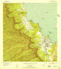
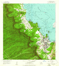
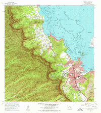
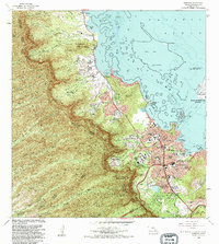
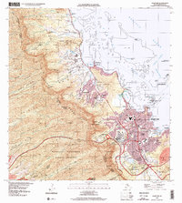
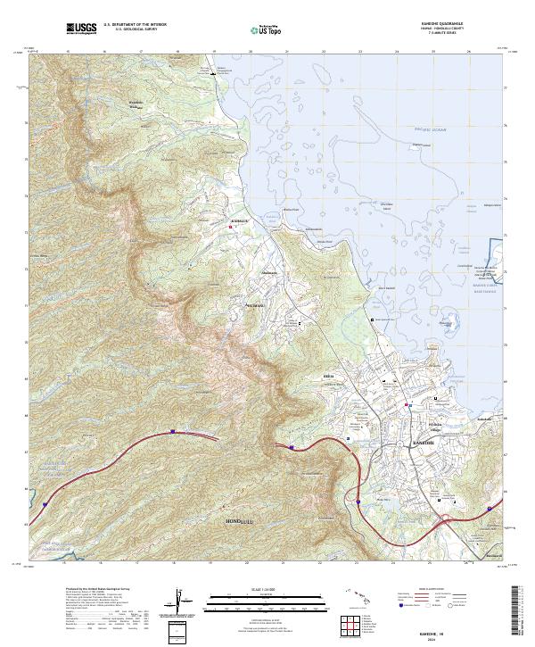
O'ahu’s windward coast is defined here by the steep emerald rises of the Ko'olau Range and a series of ancient coastal features. From Kahalu'u to Kaneohe, the landscape is a mix of suburban growth and deeply rooted cultural sites. Notable among these are the He'eia Pond and Kanohuluiwi Fish Pond, which reflect traditional Hawaiian aquaculture. The area serves as a significant memorial landscape, containing the Valley of the Temples Memorial Park, the Hawaii State Veterans Cem, and the Hawaiian Memorial Park Cem. Educational and civic centers like Windward Community College and the Abner Paki Hale Kaneohe Courthouse anchor the modern community of Heeia. Further north, smaller settlements like Waiahole-Waikane maintain a more rural character, connected by historic routes like Waiahole Valley Rd.
Find a feature on this map
179 named features on this map. Tap any name to fly to it.
Don’t see what you’re looking for? This feature index may not catch every label — zoom into the map to look around manually.
Map Details
Editions of this 2024 Kaneohe Map
This is the sole edition of this map. No revisions or reprints were ever made.
Historical Maps of Heeia Through Time
6 maps found