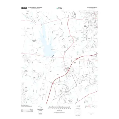
2013 Map of Kannapolis
USGS Topo · Published 2013About this map
Concord Regional Airport anchors the southern portion of this landscape, marking a period of significant suburban expansion and infrastructure development in the early 21st century. The map reveals a transition from traditional rural crossroad communities like Poplar Tent and Cannon Crossroads to more densely organized residential clusters such as Shady Brook and Fisher Town. Water remains a central geographic feature, with Coddle Creek and the Rocky River carving through the terrain, flanked by community landmarks like Macedonia Church and Odell School. The industrial and milling history of the region is reflected in names like Cox Mill, while smaller settlements such as Deweese and Glass provide touchpoints for local historians and genealogists tracing the evolution of these Piedmont communities during a time of rapid growth.
Find a feature on this map
318 named features on this map. Tap any name to fly to it.
Don’t see what you’re looking for? This feature index may not catch every label — zoom into the map to look around manually.
Map Details
Editions of this 2013 Kannapolis Map
This is the sole edition of this map. No revisions or reprints were ever made.
Other maps of this area

1893 · Statesville
USGS Topo · 1:125,000

1941 · Charlotte
USGS Topo · 1:125,000

1942 · Charlotte
USGS Topo · 1:125,000

1948 · Derita
USGS Topo · 1:24,000

1949 · Kannapolis
USGS Topo · 1:24,000

1949 · Harrisburg
USGS Topo · 1:24,000

1949 · Concord SE
USGS Topo · 1:24,000

1950 · Concord
USGS Topo · 1:24,000

1953 · Charlotte
USGS Topo · 1:250,000

1954 · Charlotte
USGS Topo · 1:250,000