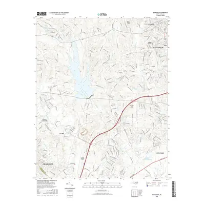
2016 Map of Kannapolis
USGS Topo · Published 2016About this map
The boundary between Cabarrus and Mecklenburg counties anchors this 2016 survey, a landscape defined by the suburban expansion of the Charlotte and Concord metropolitan areas. Water management and drainage are central to the terrain, marked by systems like Irish Buffalo Creek and Coddle Creek, as well as localized impoundments such as Barr Lake and Seaford Pond. The map captures a moment of intense transportation and infrastructure development, featuring the Concord Regional Airport and the complex web of residential roads surrounding the core of Kannapolis. While modern housing developments predominate, older place names like Poplar Tent, Cannon Crossroads, and Cox Mill persist, serving as identifiers for formerly rural crossroads that have been absorbed into the modern Piedmont sprawl. Small residential enclaves like Fisher Town and Shady Brook illustrate the fine-grained residential patterns typical of this era's growth.
Find a feature on this map
253 named features on this map. Tap any name to fly to it.
Don’t see what you’re looking for? This feature index may not catch every label — zoom into the map to look around manually.
Map Details
Editions of this 2016 Kannapolis Map
This is the sole edition of this map. No revisions or reprints were ever made.
Other maps of this area

1893 · Statesville
USGS Topo · 1:125,000

1941 · Charlotte
USGS Topo · 1:125,000

1942 · Charlotte
USGS Topo · 1:125,000

1948 · Derita
USGS Topo · 1:24,000

1949 · Kannapolis
USGS Topo · 1:24,000

1949 · Harrisburg
USGS Topo · 1:24,000

1949 · Concord SE
USGS Topo · 1:24,000

1950 · Concord
USGS Topo · 1:24,000

1953 · Charlotte
USGS Topo · 1:250,000

1954 · Charlotte
USGS Topo · 1:250,000