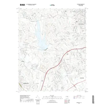
2019 Map of Kannapolis
USGS Topo · Published 2019About this map
Kannapolis and its surrounding communities are shown here at a moment of significant infrastructure expansion, where the traditional Piedmont landscape meets modern aviation and suburban development. The southern portion of the map is anchored by the Concord Regional Airport, situated just north of the Charlotte city limits. The terrain is defined by the winding course of the Rocky River and numerous tributaries like Coddle Creek and Irish Buffalo Creek, which have been dammed to form local water bodies such as Earnhardt Lake, Barr Lake, and Seaford Pond. These waterways separate distinct neighborhoods and older settlements including Fisher Town, West Brook, and Poplar Tent. The road network, including the prominent S Dale Earnhardt Blvd, illustrates the area's growth and its connection to the region's industrial and racing heritage. Long-standing local landmarks like Odell School Rd and Macedonia Church Rd provide vital touchpoints for those researching the genealogy and geographic evolution of this Cabarrus County corridor.
Find a feature on this map
278 named features on this map. Tap any name to fly to it.
Don’t see what you’re looking for? This feature index may not catch every label — zoom into the map to look around manually.
Map Details
Editions of this 2019 Kannapolis Map
This is the sole edition of this map. No revisions or reprints were ever made.
Other maps of this area

1893 · Statesville
USGS Topo · 1:125,000

1941 · Charlotte
USGS Topo · 1:125,000

1942 · Charlotte
USGS Topo · 1:125,000

1948 · Derita
USGS Topo · 1:24,000

1949 · Kannapolis
USGS Topo · 1:24,000

1949 · Harrisburg
USGS Topo · 1:24,000

1949 · Concord SE
USGS Topo · 1:24,000

1950 · Concord
USGS Topo · 1:24,000

1953 · Charlotte
USGS Topo · 1:250,000

1954 · Charlotte
USGS Topo · 1:250,000