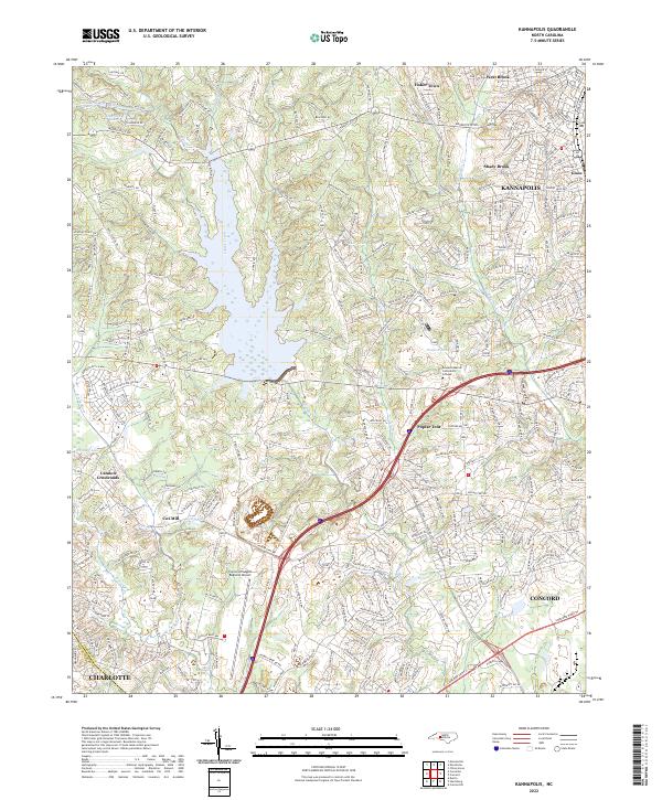
2022 Map of Kannapolis
USGS Topo · Published 2022About this map
Kannapolis and the northern outskirts of Charlotte define this area of the Piedmont, where rapid suburban expansion meets established industrial and rural crossroads. The landscape is structured by the winding course of Coddle Creek, which feeds into the larger reservoir and flows toward the Rocky River in the southwest. The interplay of regional infrastructure is evident in the presence of the Concord-Padgett Regional Airport and the campus of Rowan-Cabarrus Community College, reflecting the area's transition into a modern educational and transportation hub.
Find a feature on this map
256 named features on this map. Tap any name to fly to it.
Don’t see what you’re looking for? This feature index may not catch every label — zoom into the map to look around manually.
Map Details
Editions of this 2022 Kannapolis Map
This is the sole edition of this map. No revisions or reprints were ever made.
Other maps of this area

1893 · Statesville
USGS Topo · 1:125,000

1941 · Charlotte
USGS Topo · 1:125,000

1942 · Charlotte
USGS Topo · 1:125,000

1948 · Derita
USGS Topo · 1:24,000

1949 · Kannapolis
USGS Topo · 1:24,000

1949 · Harrisburg
USGS Topo · 1:24,000

1949 · Concord SE
USGS Topo · 1:24,000

1950 · Concord
USGS Topo · 1:24,000

1953 · Charlotte
USGS Topo · 1:250,000

1954 · Charlotte
USGS Topo · 1:250,000