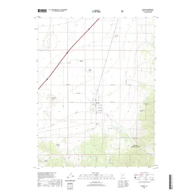
2020 Map of Kanosh
USGS Topo · Published 2020About this map
Kanosh and the smaller settlement of Hatton anchor this corner of the Pahvant Valley, where the flat agricultural basin meets the rising slopes of the Fishlake National Forest. The map documents a rural landscape defined by historic water rights and family heritage, evidenced by the presence of the Anderson Family Cem and the Hockman Cem. Water sources like Corn Cr and Hot Spring are vital features in this arid environment, dictating the placement of early homesteads and the modern street grid. To the west, the geologically significant Black Rock Volcano rises from the valley floor, while the eastern terrain is carved by numerous drainages including Kanosh Canyon, Wine Hollow Canyon, and Dameron Canyon. This topographic record provides a clear view of the area's transition from the developed valley roads like S Main St to the primitive backcountry of the Dual Springs region.
Find a feature on this map
36 named features on this map. Tap any name to fly to it.
Don’t see what you’re looking for? This feature index may not catch every label — zoom into the map to look around manually.
Map Details
Editions of this 2020 Kanosh Map
This is the sole edition of this map. No revisions or reprints were ever made.
Other maps of this area

1885 · Beaver
USGS Topo · 1:250,000

1932 · Sevier
USGS Topo · 1:62,500

1935 · Sevier
USGS Topo · 1:62,500

1953 · Richfield
USGS Topo · 1:250,000

1958 · Richfield
USGS Topo · 1:250,000

1960 · Meadow
USGS Topo · 1:24,000

1961 · Fillmore
USGS Topo · 1:24,000

1962 · Fillmore
USGS Topo · 1:62,500

1962 · Tabernacle Hill
USGS Topo · 1:62,500

1962 · Cove Fort
USGS Topo · 1:62,500