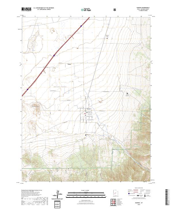
2023 Map of Kanosh
USGS Topo · Published 2023About this map
Kanosh sits at the base of the Pahvant Range, where the steep drainage of Kanosh Canyon meets the floor of the Pahvant Valley. This modern survey reveals a landscape shaped by both water and volcanic history, characterized by the Black Rock Volcano to the west and the perennial flow of Corn Creek nourishing the settlement. For those tracing local history, the map identifies several distinct burial sites including the Kanosh Indian Village Cem and the Hockman Cem, reflecting a long record of habitation. The transition from the agricultural valley to the high country of the Fishlake National Forest is well-defined, with family-named landmarks like the Anderson Family Cem and the small settlement of Hatton marking the northern edge of the quadrangle.
Find a feature on this map
34 named features on this map. Tap any name to fly to it.
Don’t see what you’re looking for? This feature index may not catch every label — zoom into the map to look around manually.
Map Details
Editions of this 2023 Kanosh Map
This is the sole edition of this map. No revisions or reprints were ever made.
Other maps of this area

1885 · Beaver
USGS Topo · 1:250,000

1932 · Sevier
USGS Topo · 1:62,500

1935 · Sevier
USGS Topo · 1:62,500

1953 · Richfield
USGS Topo · 1:250,000

1958 · Richfield
USGS Topo · 1:250,000

1960 · Meadow
USGS Topo · 1:24,000

1961 · Fillmore
USGS Topo · 1:24,000

1962 · Fillmore
USGS Topo · 1:62,500

1962 · Tabernacle Hill
USGS Topo · 1:62,500

1962 · Cove Fort
USGS Topo · 1:62,500