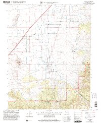
2001 Map of Kanosh
USGS Topo · Published 2003About this map
Kanosh sits at the foot of the mountains where the Pahvant Valley meets the rising terrain of the Fishlake National Forest. This 2001 revision highlights a landscape defined by water management and geological features, with an aqueduct and numerous wells supporting the local agricultural economy, including a feed lot north of town. The settlement patterns are clear, showing the grid of Kanosh alongside the Kanosh Indian Village and the smaller community of Hatton to the northwest.
Find a feature on this map
41 named features on this map. Tap any name to fly to it.
Don’t see what you’re looking for? This feature index may not catch every label — zoom into the map to look around manually.
Map Details
Editions of this 2001 Kanosh Map
This is the sole edition of this map. No revisions or reprints were ever made.
Other maps of this area

1885 · Beaver
USGS Topo · 1:250,000

1932 · Sevier
USGS Topo · 1:62,500

1935 · Sevier
USGS Topo · 1:62,500

1953 · Richfield
USGS Topo · 1:250,000

1958 · Richfield
USGS Topo · 1:250,000

1960 · Meadow
USGS Topo · 1:24,000

1961 · Fillmore
USGS Topo · 1:24,000

1962 · Fillmore
USGS Topo · 1:62,500

1962 · Tabernacle Hill
USGS Topo · 1:62,500

1962 · Cove Fort
USGS Topo · 1:62,500