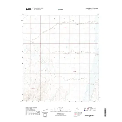
2017 Map of Kantishna River A-1 SE
USGS Topo · Published 2017About this map
The Toklat River braided stream system dominates the eastern edge of this landscape in the Denali Borough, showing the shifting nature of glacial runoff in the interior. This region is characterized by significant topographical variation, where the drainage of Clear Cr flows northward through a series of valleys and ridges. The map meticulously documents the Public Land Survey System grid, including the intersection of townships T9s R13w, T10s R13w, T9s R14w, and T10s R14w. The western portion of the quadrangle rises into more complex terrain with tight contour lines indicating steep elevation changes above the lower creek beds, offering a detailed look at the hydrology and land partitions in this part of the Alaska wilderness.
Find a feature on this map
6 named features on this map. Tap any name to fly to it.
Don’t see what you’re looking for? This feature index may not catch every label — zoom into the map to look around manually.
Map Details
Editions of this 2017 Kantishna River A-1 SE Map
This is the sole edition of this map. No revisions or reprints were ever made.
Other maps of this area

1948 · Kantishna River
USGS Topo · 1:250,000

1950 · Fairbanks
USGS Topo · 1:250,000

1951 · Healy
USGS Topo · 1:250,000

1951 · Kantishna River
USGS Topo · 1:250,000

1951 · Fairbanks
USGS Topo · 1:250,000

1951 · Mount McKinley D-1
USGS Topo · 1:63,360

1951 · Healy D-6
USGS Topo · 1:63,360

1952 · Mount McKinley
USGS Topo · 1:250,000

1952 · Fairbanks A-6
USGS Topo · 1:63,360

1952 · Kantishna River A-1
USGS Topo · 1:63,360