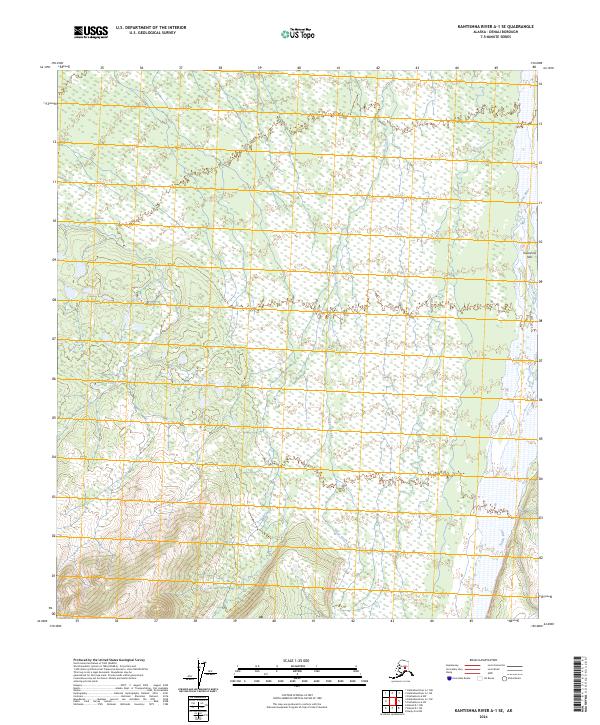
2024 Map of Kantishna River A-1 SE
USGS Topo · Published 2024About this map
The Kantishna Hills rise above a landscape defined by the shifting braids of the Toklat River in this survey of the Denali region. This portion of the Alaska interior is characterized by the convergence of glacial meltwater and complex wetland systems, where Clear Creek meanders through the expansive flats before joining the larger river system. The map provides a detailed view of the terrain as it existed in the early 21st century, revealing the natural drainage patterns and topographical contours that have historically dictated travel and seasonal land use in this part of the borough. The absence of permanent roads or settlements highlights the wilderness character of the area, making the map a essential reference for understanding the hydrological and geological structure of the Toklat River valley.
Find a feature on this map
7 named features on this map. Tap any name to fly to it.
Don’t see what you’re looking for? This feature index may not catch every label — zoom into the map to look around manually.
Map Details
Editions of this 2024 Kantishna River A-1 SE Map
This is the sole edition of this map. No revisions or reprints were ever made.
Other maps of this area

1948 · Kantishna River
USGS Topo · 1:250,000

1950 · Fairbanks
USGS Topo · 1:250,000

1951 · Healy
USGS Topo · 1:250,000

1951 · Kantishna River
USGS Topo · 1:250,000

1951 · Fairbanks
USGS Topo · 1:250,000

1951 · Mount McKinley D-1
USGS Topo · 1:63,360

1951 · Healy D-6
USGS Topo · 1:63,360

1952 · Mount McKinley
USGS Topo · 1:250,000

1952 · Fairbanks A-6
USGS Topo · 1:63,360

1952 · Kantishna River A-1
USGS Topo · 1:63,360