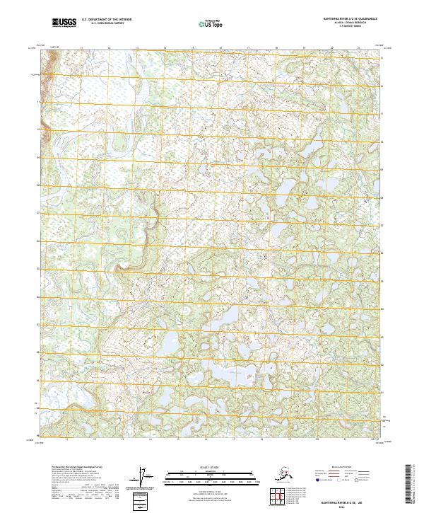
2024 Map of Kantishna River A-2 SE
USGS Topo · Published 2024About this map
Kantishna River and the meandering Bearpaw River define this interior Alaskan landscape, showing the complex hydrology of the Denali Borough. The presence of the Muldrow Glacier in the southeastern portion of the map indicates the significant glacial influence on the surrounding terrain and drainage patterns. This contemporary survey records the intricate network of water bodies, including Chitsia Creek and the clustered Alma Lakes, which are characteristic of the region's low-lying wetlands and floodplains. The map provides a detailed view of the Public Land Survey System grids, such as t10s r16w and t9s r15w, which are essential for understanding land divisions in this largely undeveloped wilderness. This data serves as a modern baseline for tracking hydrological shifts and land use within this specific section of the Alaskan interior.
Find a feature on this map
10 named features on this map. Tap any name to fly to it.
Don’t see what you’re looking for? This feature index may not catch every label — zoom into the map to look around manually.
Map Details
Editions of this 2024 Kantishna River A-2 SE Map
This is the sole edition of this map. No revisions or reprints were ever made.
Other maps of this area

1948 · Kantishna River
USGS Topo · 1:250,000

1951 · Kantishna River
USGS Topo · 1:250,000

1951 · Mount McKinley D-1
USGS Topo · 1:63,360

1952 · Mount McKinley
USGS Topo · 1:250,000

1952 · Kantishna River A-1
USGS Topo · 1:63,360

1952 · Kantishna River
USGS Topo · 1:250,000

1952 · Kantishna River A-2
USGS Topo · 1:63,360
1953 · Kantishna River A-1
USGS Topo · 1:63,360

1954 · Mount McKinley D-2
USGS Topo · 1:63,360

1954 · Mount McKinley D-1
USGS Topo · 1:63,360