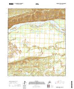
2017 Map of Kantishna River D-2 NW
USGS Topo · Published 2017About this map
The Tanana River dominates this Alaskan landscape, carving a wide path through the Yukon-Koyukuk region. To the north, the terrain rises sharply at Bean Ridge, where the elevation provides a distinct contrast to the expansive river flats and wetlands below. The intricate hydrography of the valley is visible through features like Hot Springs Slough, which meanders parallel to the main river channel, and Rock Cr, which drains the southern slopes of the ridge. This area represents a classic subarctic riverine environment, characterized by shifting channels and seasonal floodplains that have historically dictated travel and subsistence patterns in the interior of Alaska.
Find a feature on this map
8 named features on this map. Tap any name to fly to it.
Don’t see what you’re looking for? This feature index may not catch every label — zoom into the map to look around manually.
Map Details
Editions of this 2017 Kantishna River D-2 NW Map
This is the sole edition of this map. No revisions or reprints were ever made.
Other maps of this area

1948 · Kantishna River
USGS Topo · 1:250,000

1951 · Kantishna River
USGS Topo · 1:250,000

1951 · Tanana
USGS Topo · 1:250,000

1952 · Tanana A-3
USGS Topo · 1:63,360

1952 · Tanana A-2
USGS Topo · 1:63,360

1952 · Kantishna River
USGS Topo · 1:250,000

1952 · Kantishna River D-2
USGS Topo · 1:63,360

1952 · Kantishna River D-3
USGS Topo · 1:63,360

1953 · Tanana A-2
USGS Topo · 1:63,360

1953 · Tanana A-3
USGS Topo · 1:63,360