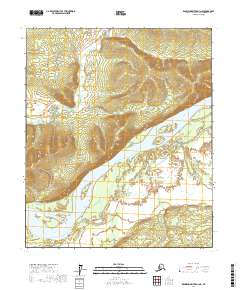
2017 Map of Kantishna River D-3 NE
USGS Topo · Published 2017About this map
Tanana River dominates the southern half of this landscape, its braided channels and sandbars shifting through the lowlands of the Alaska interior. The waterway serves as the primary geographical anchor for this territory within the t1n r18w and t1n r17w townships. To the north, the elevation rises toward Bean Ridge, a prominent landform that separates the river valley from the drainages of Patterson Cr and Rock Cr. The map illustrates a largely unsettled wilderness where the natural hydrology and topographical relief dictate the movement of water and potentially seasonal travelers. The intricate contour lines around the ridge provide a clear view of the drainage patterns that feed into the larger Tanana system, reflecting the character of the Yukon-Koyukuk region before significant modern development.
Find a feature on this map
8 named features on this map. Tap any name to fly to it.
Don’t see what you’re looking for? This feature index may not catch every label — zoom into the map to look around manually.
Map Details
Editions of this 2017 Kantishna River D-3 NE Map
This is the sole edition of this map. No revisions or reprints were ever made.
Other maps of this area

1948 · Kantishna River
USGS Topo · 1:250,000

1951 · Kantishna River
USGS Topo · 1:250,000

1951 · Tanana
USGS Topo · 1:250,000

1952 · Tanana A-3
USGS Topo · 1:63,360

1952 · Tanana A-2
USGS Topo · 1:63,360

1952 · Kantishna River
USGS Topo · 1:250,000

1952 · Kantishna River D-2
USGS Topo · 1:63,360

1952 · Kantishna River D-3
USGS Topo · 1:63,360

1953 · Tanana A-2
USGS Topo · 1:63,360

1953 · Tanana A-3
USGS Topo · 1:63,360