2024 Map of Kapaa
USGS Topo · Published 2024About this map
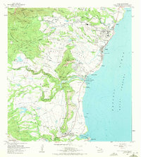
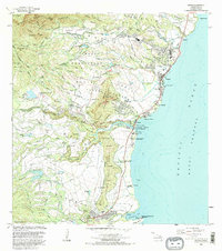
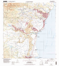
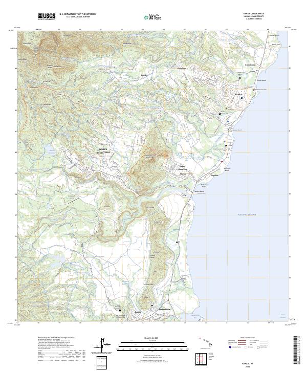
Wailua Homesteads and Kapa‘a anchor this coastal survey of eastern Kauai, where the landscape transitions from the Pacific shore to the heights of the Makaleha Mountains. The coastal corridor is densely marked with heritage sites, including the Kapaa First Hawaiian Church and several community-specific burial grounds like the Kapaa Chinese Cemetery and Saint Catherine Cemetery. The interior reveals a complex water management system with features like the Hala‘ula Reservoir and Wailua Reservoir feeding the lush valleys.
Find a feature on this map
100 named features on this map. Tap any name to fly to it.
Don’t see what you’re looking for? This feature index may not catch every label — zoom into the map to look around manually.
Map Details
Editions of this 2024 Kapaa Map
This is the sole edition of this map. No revisions or reprints were ever made.
Historical Maps of Kawaihau Through Time
5 maps found