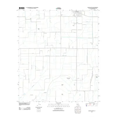
2012 Map of Kaplan South
USGS Topo · Published 2012About this map
The southern outskirts of Kaplan and the coastal prairie of Vermilion Parish are defined by an intricate network of drainage and irrigation canals, reflecting the region's agricultural and industrial heritage in the early 21st century. Significant waterworks like the Bull Moose Canal, Sledge Canal, and Cow Island Number One Canal crisscross the landscape, supporting the local economy alongside the Mulvey Oil Field.
Find a feature on this map
102 named features on this map. Tap any name to fly to it.
Don’t see what you’re looking for? This feature index may not catch every label — zoom into the map to look around manually.
Map Details
Editions of this 2012 Kaplan South Map
This is the sole edition of this map. No revisions or reprints were ever made.
Other maps of this area

1932 · Abbeville SW
USGS Topo · 1:31,680

1932 · Abbeville NW
USGS Topo · 1:31,680

1946 · Morse
USGS Topo · 1:31,680

1946 · Schooner Bayou SE
USGS Topo · 1:31,680

1946 · Leroy
USGS Topo · 1:31,680

1946 · Schooner Bayou NE
USGS Topo · 1:31,680

1946 · Schooner Bayou NW
USGS Topo · 1:31,680

1946 · Kaplan
USGS Topo · 1:31,680

1946 · Schooner Bayou SW
USGS Topo · 1:31,680

1952 · Lake Charles
USGS Topo · 1:250,000