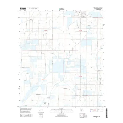
2015 Map of Kaplan South
USGS Topo · Published 2015About this map
The coastal prairie landscape of Vermilion Parish unfolds south of Kaplan, defined by a complex network of drainage and irrigation infrastructure essential to the region's agricultural heritage. Numerous named waterways, including Bull Moose Canal, Number Five Canal, and Zigler Canal, crisscross the township lines, revealing the engineered nature of this low-lying terrain. To the south, the topography transitions into a series of slightly elevated landforms identified as islands, such as Long Island, Second Island, and Greens Pine Island, which rise above the surrounding marshy levels.
Find a feature on this map
93 named features on this map. Tap any name to fly to it.
Don’t see what you’re looking for? This feature index may not catch every label — zoom into the map to look around manually.
Map Details
Editions of this 2015 Kaplan South Map
This is the sole edition of this map. No revisions or reprints were ever made.
Other maps of this area

1932 · Abbeville SW
USGS Topo · 1:31,680

1932 · Abbeville NW
USGS Topo · 1:31,680

1946 · Morse
USGS Topo · 1:31,680

1946 · Schooner Bayou SE
USGS Topo · 1:31,680

1946 · Leroy
USGS Topo · 1:31,680

1946 · Schooner Bayou NE
USGS Topo · 1:31,680

1946 · Schooner Bayou NW
USGS Topo · 1:31,680

1946 · Kaplan
USGS Topo · 1:31,680

1946 · Schooner Bayou SW
USGS Topo · 1:31,680

1952 · Lake Charles
USGS Topo · 1:250,000