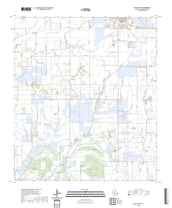
2024 Map of Kaplan South
USGS Topo · Published 2024About this map
The town of Kaplan serves as the northern anchor of this landscape, where the grid of city streets like W 1st St and S Cushing Ave meets the expansive agricultural reaches of Vermilion Parish. The map reveals an intricate network of drainage and irrigation essential to the region's history, defined by significant waterways such as Bull Moose Canal and Zigler Canal. To the south, the terrain shifts into a complex system of wetlands and low-lying landforms, including Long Island, Second Island, and Greens Pine Island. This area is particularly rich for genealogical research, documenting several family-named burial sites that dot the countryside. Researchers can locate the Pierre Marceaux Cem, Hebert Cem, and Le Maire Cem, which provide a geographic record of early settlers and their landholdings. The transition from the developed town center of Kaplan to the remote, canal-threaded marshes highlights the unique coastal prairie and wetland geography of southern Louisiana.
Find a feature on this map
95 named features on this map. Tap any name to fly to it.
Don’t see what you’re looking for? This feature index may not catch every label — zoom into the map to look around manually.
Map Details
Editions of this 2024 Kaplan South Map
This is the sole edition of this map. No revisions or reprints were ever made.
Other maps of this area

1932 · Abbeville SW
USGS Topo · 1:31,680

1932 · Abbeville NW
USGS Topo · 1:31,680

1946 · Morse
USGS Topo · 1:31,680

1946 · Schooner Bayou SE
USGS Topo · 1:31,680

1946 · Leroy
USGS Topo · 1:31,680

1946 · Schooner Bayou NE
USGS Topo · 1:31,680

1946 · Schooner Bayou NW
USGS Topo · 1:31,680

1946 · Kaplan
USGS Topo · 1:31,680

1946 · Schooner Bayou SW
USGS Topo · 1:31,680

1952 · Lake Charles
USGS Topo · 1:250,000