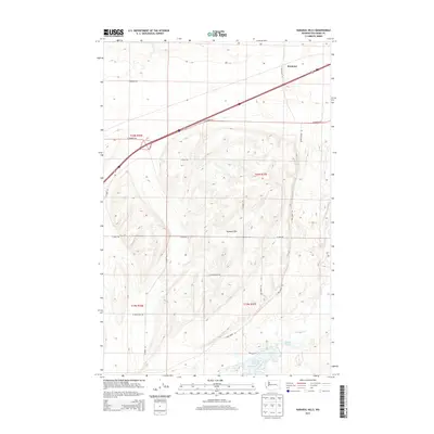
2013 Map of Karakul Hills
USGS Topo · Published 2013About this map
Keystone serves as a primary reference point in the northern portion of this landscape, situated along a prominent rail corridor and highway route. The topography is dominated by the Karakul Hills, which rise above a network of drainages and small basins. The southern terrain features a concentration of water bodies, most notably Cow Lake and Hallin Lake, which are fed by Lugenbeal Cr and the waters of Cow Cr. The distribution of section lines and township boundaries, including t20n r37e and t19n r37e, illustrates the systematic land division of this part of Washington. A grid of rural roads, such as E Wellsandt Rd and E Rehn Rd, provides access to the agricultural and upland areas, connecting the scattered water features with the settlement at Keystone.
Find a feature on this map
22 named features on this map. Tap any name to fly to it.
Don’t see what you’re looking for? This feature index may not catch every label — zoom into the map to look around manually.
Map Details
Editions of this 2013 Karakul Hills Map
This is the sole edition of this map. No revisions or reprints were ever made.
Other maps of this area

1953 · Ritzville
USGS Topo · 1:250,000

1959 · Ritzville
USGS Topo · 1:250,000

1964 · Karakul Hills
USGS Topo · 1:24,000

1964 · Macall
USGS Topo · 1:24,000

1964 · Palm Lake
USGS Topo · 1:24,000

1964 · Marengo
USGS Topo · 1:24,000

1965 · Ritzville
USGS Topo · 1:250,000

1967 · Ritzville SE
USGS Topo · 1:24,000

1967 · Ritzville NE
USGS Topo · 1:24,000

1969 · Sprague Lake
USGS Topo · 1:24,000