
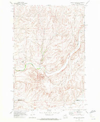
1967 Map of Ritzville NE
USGS Topo · Published 1970About this map
The settlement of Tokio and the northern reaches of Ritzville anchor this Adams County landscape during the late 1960s. The region is defined by a rhythmic pattern of agricultural plateaus and coulees, where industrial hubs like the Grain Elevators at Tokio sit alongside the Northern Pacific railroad line. This transportation corridor was central to the local economy, facilitating the movement of grain from the surrounding dryland wheat country.
Find a feature on this map
26 named features on this map. Tap any name to fly to it.
Don’t see what you’re looking for? This feature index may not catch every label — zoom into the map to look around manually.
Map Details
Editions of this 1967 Ritzville NE Map
This is the sole edition of this map. No revisions or reprints were ever made.
Other maps of this area

1953 · Ritzville
USGS Topo · 1:250,000

1959 · Ritzville
USGS Topo · 1:250,000

1964 · Karakul Hills
USGS Topo · 1:24,000

1964 · Marengo
USGS Topo · 1:24,000

1965 · Ritzville
USGS Topo · 1:250,000

1967 · Ritzville SW
USGS Topo · 1:24,000

1967 · Ritzville SE
USGS Topo · 1:24,000

1967 · Ritzville NW
USGS Topo · 1:24,000

1969 · Lamona
USGS Topo · 1:24,000
1969 · Sprague Lake SW
USGS Topo · 1:24,000