
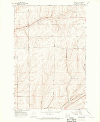
1967 Map of Ritzville NW
USGS Topo · Published 1970About this map
The Chicago Milwaukee St Paul and Pacific railroad cuts a diagonal path across this high-plateau landscape, anchoring the small settlements of Packard and Marcellus in the late 1960s. The terrain is defined by the dramatic scalloping of the Channeled Scablands, where Rocky Coulee, Bauer Coulee, and Marcellus Coulee carve through the earth. These geological features dictated the placement of early infrastructure, forcing many arterial routes like Tokio Road and Schoessler Road to navigate around the steep coulee walls.
Find a feature on this map
29 named features on this map. Tap any name to fly to it.
Don’t see what you’re looking for? This feature index may not catch every label — zoom into the map to look around manually.
Map Details
Editions of this 1967 Ritzville NW Map
This is the sole edition of this map. No revisions or reprints were ever made.
Other maps of this area

1953 · Ritzville
USGS Topo · 1:250,000

1959 · Ritzville
USGS Topo · 1:250,000

1965 · Ritzville
USGS Topo · 1:250,000

1967 · Ritzville SW
USGS Topo · 1:24,000

1967 · Ritzville SE
USGS Topo · 1:24,000

1967 · Schoonover
USGS Topo · 1:24,000

1967 · Ritzville NE
USGS Topo · 1:24,000
1967 · Reiman SE
USGS Topo · 1:24,000

1968 · Sylvan Lake
USGS Topo · 1:24,000

1969 · Lamona
USGS Topo · 1:24,000