
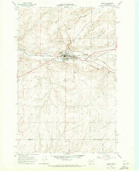
1968 Map of Sylvan Lake
USGS Topo · Published 1971About this map
Sylvan Lake defines the central basin of this landscape at the border of Lincoln and Adams counties. The mid-century map documents a transition in regional transport as the Burlington Northern railroad corridor follows the valley of Coal Creek through the small settlement of Nemo. This area of eastern Washington is characterized by a network of drainage systems, including Crab Creek and several isolated wells, which support the sparsely populated agricultural terrain. Local infrastructure is reflected in a series of named rural thoroughfares such as Davis Road, Nielson Road, and Schoonover Road. The map also captures the industrial footprint of the era, including a significant Pipeline crossing the northern hills and several strategically placed Gravel Pits and borrow pits near the rail and water routes.
Find a feature on this map
20 named features on this map. Tap any name to fly to it.
Don’t see what you’re looking for? This feature index may not catch every label — zoom into the map to look around manually.
Map Details
Editions of this 1968 Sylvan Lake Map
This is the sole edition of this map. No revisions or reprints were ever made.
Other maps of this area

1953 · Ritzville
USGS Topo · 1:250,000

1959 · Ritzville
USGS Topo · 1:250,000

1965 · Ritzville
USGS Topo · 1:250,000

1967 · Schoonover
USGS Topo · 1:24,000

1967 · Reiman
USGS Topo · 1:24,000

1967 · Ritzville NW
USGS Topo · 1:24,000

1968 · Coffeepot Lake
USGS Topo · 1:24,000

1968 · Pacific Lake
USGS Topo · 1:24,000
1968 · Odessa
USGS Topo · 1:24,000

1969 · Cormana Lake
USGS Topo · 1:24,000