
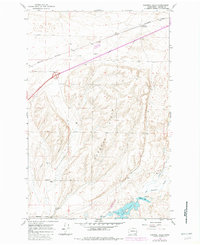
1964 Map of Karakul Hills
USGS Topo · Published 1965About this map
The Northern Pacific railroad corridor defines the northern edge of this high-plateau landscape, where the small community of Keystone is situated. Agriculture and logistics are central to the area's development, evidenced by the prominent Grain Elevator and various Gravel Pit operations that support local infrastructure. To the south, the terrain rises into the distinctive Karakul Hills, a series of ridges topped by Stockman and dissected by a network of drainage systems. The southern portion of the quadrangle is anchored by Cow Lake, which is fed by Cow Creek and the Lugenbeal waterway. This 1964 survey captures the region just as modern infrastructure was expanding, shown by the dual-lane route of Highway 90 and a long-distance Pipeline that traverses the hills, contrasting with the older rural landmarks like Hallin Lake and isolated Well sites.
Find a feature on this map
20 named features on this map. Tap any name to fly to it.
Don’t see what you’re looking for? This feature index may not catch every label — zoom into the map to look around manually.
Map Details
Editions of this 1964 Karakul Hills Map
2 editions found
Other maps of this area

1953 · Ritzville
USGS Topo · 1:250,000

1959 · Ritzville
USGS Topo · 1:250,000

1964 · Macall
USGS Topo · 1:24,000

1964 · Palm Lake
USGS Topo · 1:24,000

1964 · Marengo
USGS Topo · 1:24,000

1965 · Ritzville
USGS Topo · 1:250,000

1967 · Ritzville SE
USGS Topo · 1:24,000

1967 · Ritzville NE
USGS Topo · 1:24,000

1969 · Sprague Lake
USGS Topo · 1:24,000
1969 · Sprague Lake SW
USGS Topo · 1:24,000