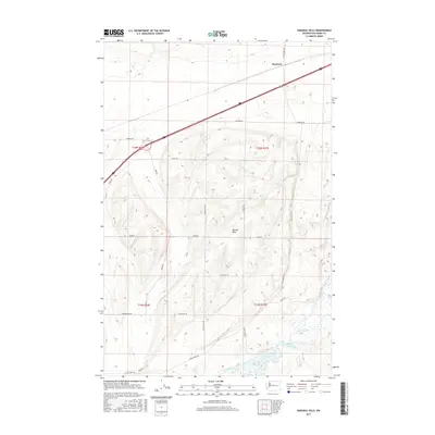
2017 Map of Karakul Hills
USGS Topo · Published 2017About this map
Karakul Hills rise across this Washington landscape in Adams County, where high-plateau terrain is marked by the distinct glacial or volcanic drainage patterns typical of the region. The settlement of Keystone sits in the north, positioned along the primary transportation corridor that bisects the quadrangle. In the southeast, the geography shifts toward a collection of water bodies, including Cow Lake and Hallin Lake, which are fed by the meandering Cow Creek and Lugenbeal Cr. The map reveals a systematic grid of rural transit, with family-named routes such as Danekas Rd, Schoessler Rd, and E Wellsandt Rd providing access to the outlying sections of T20N and T19N. This network of roads and lanes like Mason Ln illustrates the enduring agricultural and ranching layout of the area, connecting isolated points across the undulating topography of the hills.
Find a feature on this map
24 named features on this map. Tap any name to fly to it.
Don’t see what you’re looking for? This feature index may not catch every label — zoom into the map to look around manually.
Map Details
Editions of this 2017 Karakul Hills Map
This is the sole edition of this map. No revisions or reprints were ever made.
Other maps of this area

1953 · Ritzville
USGS Topo · 1:250,000

1959 · Ritzville
USGS Topo · 1:250,000

1964 · Karakul Hills
USGS Topo · 1:24,000

1964 · Macall
USGS Topo · 1:24,000

1964 · Palm Lake
USGS Topo · 1:24,000

1964 · Marengo
USGS Topo · 1:24,000

1965 · Ritzville
USGS Topo · 1:250,000

1967 · Ritzville SE
USGS Topo · 1:24,000

1967 · Ritzville NE
USGS Topo · 1:24,000

1969 · Sprague Lake
USGS Topo · 1:24,000